The Grand Canyon

I visited the Grand Canyon on a family summer trip in the summer of 1983. I’m pretty sure I have the year right, meaning I was 11 years old. It was incredible, and we even did a helicopter (or small plane?) tour.

My second visit was when Leena and I moved from Chicago to San Francisco. Because it was February, we basically traced Route 66 to Los Angeles before heading north up the I5 in California. That took us within an hour of the Grand Canyon so we made the side trip. We drove along the southern rim and though I again remember being in awe of the place, I also remember pulling off one of my better driving maneuvers. Our rig was a U-Haul truck and we were towing my car on a trailer. I managed to head down a dead end lane without a turnaround. I had to back up and swing the car perpindicular into a short driveway to turn around. Traffic stopped so I had the pressure of an audience. A couple of guys jumped out to help spot me. I nailed it on the first try. I have to thank my brother David for this – he insisted on teaching me how to back up up and steer with an axel. He taught me first on a riding tractor pulling a grass catcher, then later on our station wagon towing a camper. It’s counter intuitive: you have to steer the car a bit one way to get the trailer going the other, then steer the other direction to catch up and follow. Thanks, brother.

Anyway, where was I? Oh, the Grand Canyon. It’s still incredible, one of those sights in all the world that completely amazes me. I joke that “Grand” may be selling it short. Pictures can’t really do it justice, but I think we have quite a few worth sharing. We again visited the southern rim, and got it on a partly sunny day. We parked at the visitor center and hiked a few miles west along the rim. For the last seven miles we alternated between hiking and shuttle buses.

Leena found the canyon and helpfully pointed it out.

DAB59900-C523-4C75-A0D8-830F0596AAF5

3257E263-B856-458B-AEF2-EA7EF5004769

E09B50A4-3E43-4BFD-8EA1-0BE51C050AB5

D3AFE870-C0AC-41E1-9D9E-BB27FA5306BA

43368648-1D1C-41C1-9B9A-8503C34395EE

92CD4646-AC56-43DE-AFF8-144BF5F1229A

626C56AC-48D3-4E47-89F6-CA7B0A890BB3

BDCE334A-E6AB-4ACF-BC02-AE59ED5EAE4E

5709D733-B727-4C9B-A5AD-7C76773087F4

29309F1D-0556-4E4C-9307-E0B9026AD1F0

20339796-6DFC-4A0B-BB93-A43583FDECEA

1CFDDB16-FAF5-4AF0-8F20-D24D13077D5F

You can see the famous Bright Angel trail in this one. Someday…

36825EE0-EA32-48A6-9461-D4216ABC05D3

DF0ED4C1-AAF7-45E4-AC9A-E05CE1CD0C7E

F0AC7EB7-6B59-458A-BDEE-ECD41A592CC2

1A3D85FC-716A-4A41-8D4C-530AF8DBD8F6

A503CB28-D100-4807-9345-281295CB2C5B

493CAE0C-E5AD-49FF-B9BC-866798C30E18

9024DA02-5509-4719-890C-8479F05BB868

1EA37546-87B0-4E86-A1F5-F55747B67EFB

F3803689-4D2E-4A5E-96EF-429BB75FC67F

As you get further west along the south rim you get some glimpses of the Colorado River. Though it looks small, it’s about 100m wide.

D7867D0F-66F3-4EB4-9A23-E540A708FFCF

C1BE2F2A-32F9-455C-BB54-B5FE2F863077

B6F8C8B5-672D-4242-B5DA-44C89023FC4E

DFA73117-3C0B-4FBE-9B7B-DF6D795318AB

D81D15E0-41B7-4204-8184-8DEDA568E5D7

BF9E434C-B323-4E52-8F27-140650354ECD

D1B5B174-491B-40E8-8BE1-63C2A4A712E3

D73EAD27-EF8C-4857-A930-54F2FDBE13B7

2CB88638-AC7C-46D9-A5FF-25E2756AD7F2

88B17CEF-59E8-493E-A65C-F23204B285B6

EB3A27DF-3FDA-4B55-B59F-EB28F98F3A61

01EC3DB7-76CF-4C44-B1E3-65A6AE085065


Sedona

After Spring Training with friends in Phoenix, we started a road trip through the Southwest. We drove to Sedona for the day and did several day hikes. Our first stop was at the Oak Creek Vista where we got a look at the canyon formed by Oak Creek.

7C022628-47DC-4CA8-A5BB-25398FB27245

After a couple of miles of switchbacks we reached the floor of the canyon and followed the creek downstream. We stopped to hike the Midgley Bridge Trail.

09D03F94-CDE0-4F4E-8D03-57254C9DEC8D

Here’s Midgley Bridge spanning a tributary that joins Oak Creek.

B6AFD8E2-9178-4FD5-969E-276CACCCF761

834DDFFA-BD41-4905-8339-48FB0B723869

Our next stop was the Sugar Loaf trail which took us on a loop with a side trek up Sugar Loaf hill, pictured here.

35D75C6E-CEA0-4EC6-B6E6-A486A4122141

Some views from the trail.

40854FF3-BE4F-4BC4-93D3-A12FD8904B68

41CC1D48-2A12-4160-908B-4B4D56BBD41E

605B2755-3D97-46D7-B69A-DFAAA96641B6

7A773620-7DE3-4029-942F-5A40434A8B8D

8309924E-EC5D-43AB-BFCD-5BE529F39E8F

Our last stop was at the Cathedral Rock Trailhead. We hiked the Cathedral Rock Trail for a short distance and then took the Templeton Trail for a couple of kilometers.

F6A86C0A-9DE7-4424-ABE5-D74A051EF7F7

C27E61A7-B999-483C-90C3-E6C748FAF046

69B5F28C-6FBB-4BEE-8327-25DAB776EE63

Here’s a look up at the Cathedral Rock formation.

EAEA91FE-6645-4EAB-958C-F3AFA0181172

BA037202-CA8C-42F6-ADFC-605C2A76DB70

6D41C648-3535-4F84-A923-CF41437138BD

E7039A50-D340-4C75-BCC6-1813D9108086

B9A6B0F2-D9D3-4E1E-9C67-163FFDC60253

We returned to the Cathedral Rock trail and I took it to the top. It’s a somewhat technical trail where you have to get on all fours to get up and over some of the sections. I suppose you’d call it some minor rock climbing. Leena opted out because going down something like that would be very difficult with her knee (old soccer injury to the meniscus).

As I made my way up, the sun moved behind the rocks. The picture reminds me of the total eclipse we got to see last summer in Oregon.

65A1F1CE-3ED3-4523-972E-4D0FDD8CE367

Here’s another angle.

A8E399EF-D841-410A-80EA-923D9735F08F

At the end of the trail it just drops off. There’s a sign just in case you don’t notice.

8263E7CB-B449-44FE-BEC8-4ABFFCB1834A

AD990E82-CE4C-4BF1-88E7-FC4DD355127A

The view in the opposite direction.

BBFDE6ED-0251-496A-95BF-35207F35B6CC

The impressively tall Cathedral Rock.

682C314C-9072-46EF-9C24-4AF8E84E6FCA

This is the same view as the Templeton Trail, but from the elevated position of the Cathedral Rock trail.

5C6205AD-E809-4DBA-90F2-8E9A7955028C

A look back at the Cathedral Rock formation on the way down as the sun moved further behind the rocks.

A615518A-E62C-4733-B351-542EB01B034A

Bogatá

We stayed in Bogotá for two nights at the start of our stay in Colombia and an additional four nights at the conclusion. We flew in from Cancún after our stay on Isla Mujeres and went to a supper club promoted as an AirBnB experience. There were nine guests and two hosts. Wine flowed and we tried aguardiente, a Colombian anise-flavored liqueur. We had some appetizers before moving to the dining table for dinner. Wine continued to flow, and the host brought out two microphones for some karaoke. People got pretty into it. The party finally broke up between 1 and 2a.

We took a funicular up Monserrate, a peak overlooking Bogotá with a church on top (of course). Bogotá averages 2640m above sea level (8660 ft) while Monserrate rises to 3152m (10341 ft).

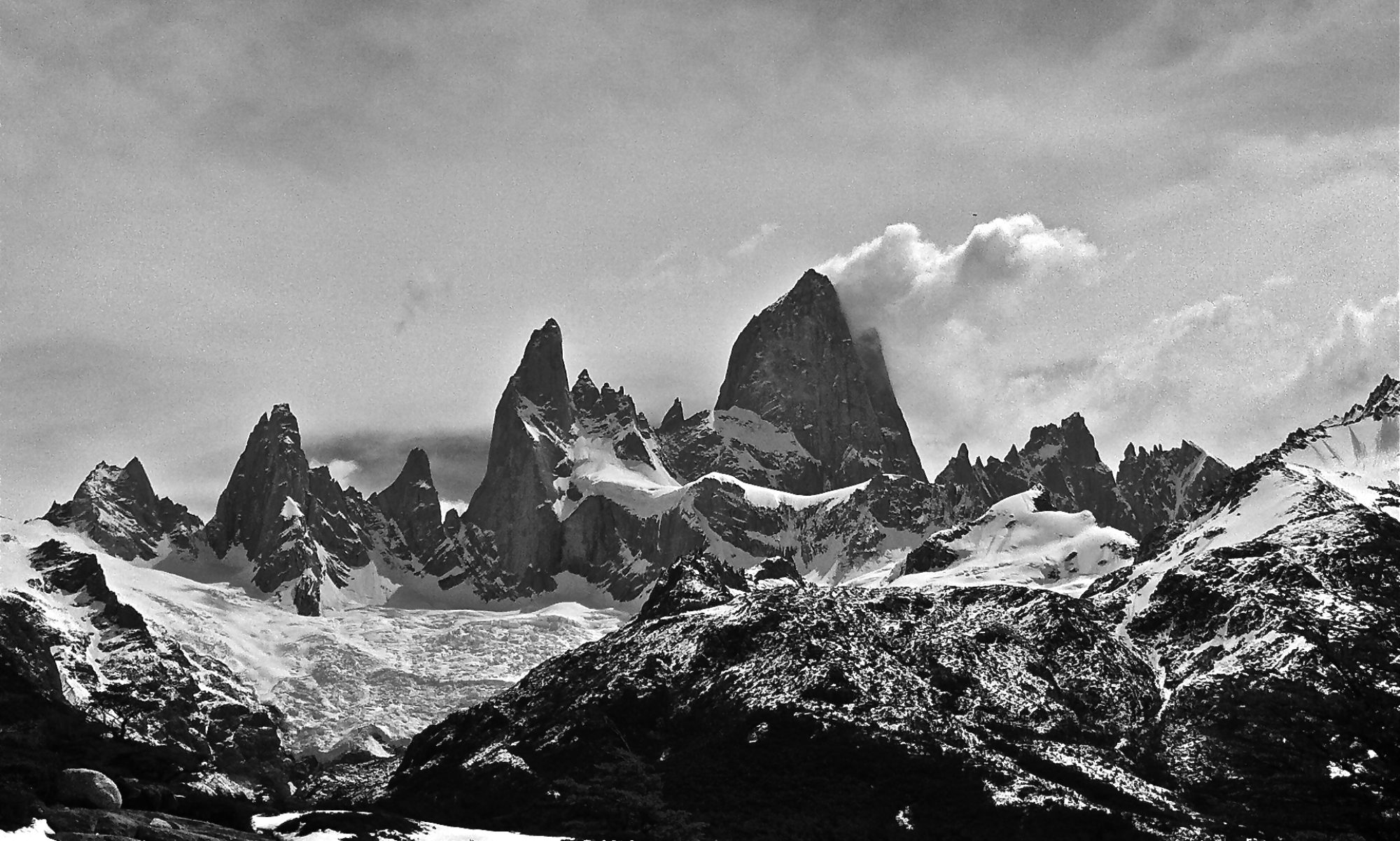
It was a mostly cloudy day, and Bogotá is generally smoggy, so the pictures reflect that. But you still get the scale of this city of 8m residents.

E00A48F7-125B-4100-92C6-8983EE471E5C

CDCE67B3-E4B9-4C7D-AA26-94B6F80A5E5F

E23255B4-4A66-4513-8DC4-CE1F22E19EDE

ECA37790-8FF6-4BEE-8999-24377992325C

DA30335A-2AA1-4110-9FAF-9CF341D49003

After enjoying the setting for a while we decided to head down. It was Sunday, so it was crowded, and the line for the funicular was estimated at two hours! We decided to take the trail down. It’s a short trail, but it descends over 400m, so it’s very steep. We took some more pictures as we descended and you can see the city a bit more clearly through less smog.

C2754EEC-F5B3-4425-9A81-18385CBB2E56

DDC837FD-B948-4E60-BD4E-4AD1281B47C8

On our second swing through Bogotá we took a guided walking tour through the heart of the city, a neighborhood named La Candalaria. Our guide was a Colombian historian with lots of great information. I even took some notes on my phone.

Before getting into history, we talked about the climate here. With its location just 5 degrees from the equator, but at an elevation of 2640m, Bogotá enjoys temperate weather all year round. The temperature averages about 16C (61F) and the highest temperature recorded in Bogotá is 25.6C (78F). Yes, it’s never hit 80 degrees F here.

New Granada, comprised of present day Colombia, Venezuela, Ecuador and Panama won independence from Spain in 1819, Bolívar became the president of the newly named country of Gran Colombia. He remained president until his death in 1830. After his death, Venezuela and Ecuador separated to become sovereign countries. No blood was shed. The present-day flags of Colombia, Venezuela and Ecaudor are all very similar. The yellow represents gold, the blue represents the sea, and the red represents the blood shed to gain independence.

Panama, incidentally, declared its independence from Colombia in 1903 with the backing of Teddy Roosevelt and the United States as the US took over construction of the Panama Canal.

We visited the site of the assassination of Jorge Gaitán on April 9, 1948. He was a far-left presidential candidate; Colombia has never had liberal leadership. He was gunned down in the street outside his office while giving a speech to his supporters. A riot broke out. The assassin was killed and his body desecrated to the point that he could not be identified. There are three primary theories on who was behind the assassination: 1) the conservatives who feared losing the presidency, 2) the center-left who thought Gaitán too liberal, and 3) the CIA.

0BE48FB2-4B2B-4918-AFCE-80516671D94F

The assassination started a period of violence in Colombia, giving rise to paramilitary (conservative) and guerilla (liberal) forces. The Cuban revolution inspired Communist forces as well, but they have never succeeded in taking power.

We learned about present-day Colombia. It’s famous for three “C’s”: coffee, chocolate, and yes, cocaine. But the top exports actually start with two other “C’s”:

1. Crude oil
2. Coal
3. Flowers
4. Coffee
5. Gold

A city of 8m residents is a lot of responsibility for one mayor, so the city is politically divided into 21 neighborhoods each with their own mayor. La Candalaria is the smallest with just 27k residents. In contrast, our guide lives in Suba which has 1.5m residents. Colombia has a population of about 47m people. About 85% are of mixed race, with another 10% of African decent and 3% indigenous. The African population is the third highest outside of Africa, after the US and Brazil. The population is 95% Catholic, 3% agnostic/atheist, 1% Jewish and 1% Muslim.

We stopped to try chicha, another Colombian drink. Chicha is an indigenous drink made from spit out corn kernels and water. This is then fermented. We got to try some. It smells like sour stale beer and tastes like sour apple cider. Honestly, it’s not bad! We tried some at 4% ABV. A long ferment can make it as strong as moonshine. The guide was impressed that everyone tried it before learning that the corn kernels in chicha are now hand mashed. No chewing involved.

The tour continued into an area of La Candeleria famous for its graffiti and street art. Our guide told the story of a prominent graffiti artist who was killed by the police about a decade ago. He was caught doing his art, and the police shot him in the back as he ran away. About a year later, Justin Bieber visited the city. Accompanied by a police escort, he made his own graffiti mural depicting the Canadian flag amidst a cannabis leaf. The case caused a lot of introspection in the city, and policies towards graffiti have dramatically shifted. It’s now tolerated, and even celebrated as part of the city. There are several thousand graffiti artists here and many are trained in graphic design and art.

34F432ED-CF82-44ED-8AD7-CE252298A1A8

9C9BDAB3-C1F4-467B-AFB2-C4540BE7C127

DCD32D8E-DD77-4F87-B85B-4596F9D14E53

We visited an art museum with a gallery of paintings by Fernando Botero, a prominent Colombian artist. He donated all of the works with the stipulation that entry be free and that they cannot be displayed outside of Colombia. In his works, Botero distorts the human (and other) figures, intentionally changing proportions and making oversized bodies. His version of the Mona Lisa was on display.

FC83EC45-AAAD-4728-B9B8-D56CDB91F645

Since Colombia was colonized by the Spanish, much of the architecture has Spanish influences. And Spanish architecture, in turn, has Moorish and Islamic influences. The water garden at the entry of the art museum is very similar to Islamic water gardens we saw in Marrakech.

6F65EA79-AF89-4964-A5A6-B9EA11CBCB4A

The tour continued to the main plaza of Bogotá, ringed by a church and government buildings for Congress, Justice, and the city government.

E204050C-507D-4960-ABB7-A1BE33E0D5B4

16B6DA12-1353-4794-A930-1E700DCFB7A7

A4080B7F-55E4-457A-88BD-E567266085A9

F9D41FB8-22FF-4784-99BE-38CBC63025B6

7D5239BD-923E-4033-936C-7F647566AF76

The tour concluded at the Gabriel García Marquéz Center. Marquéz was a Colombian author who won the 1982 Nobel Prize for Literature. We saw some dancers performing.

3D1C1BB8-E734-4BCC-9D35-15052014EB5B

After all that walking and learning, it was time for a pint!

FF31E853-415B-436F-8977-B52DDCA0A32E

Guatavita

We took a day-trip from Bogotá to visit Lake Guatavita and the town of Guatavita La Nueva. It’s a circular lake at the top of a symmetrical mountain, and it looked to me like a small version of Crater Lake in Oregon. I guessed that it was also a collapsed volcano that had filled with water.

A5485BB3-529C-4401-BF63-D6092F0D9ED1

However, though that was a common theory, it’s now believed that it’s a sinkhole that developed when underground salt deposits dissolved.

The local indigenous tribe, the Muisca, hold the lake as a sacred place. We learned from our Muisca guide that the tribe’s succession of kings comes from the son of the current king’s sister (i.e. a nephew). The successor spends his first nine years in a cave with his mother, then the following nine years in relative isolation in the cave. After that, the to-be king is stripped naked, covered with gold dust, and enters the lake to wash off the gold dust and emerge as the new king. Gold and other treasures were thrown in the lake during the ceremony. When the Spanish arrived in the 16th century, they learned of the ceremony and thought the lake was the entrance to El Dorado, or a mythical city of gold.

Multiple efforts to extract gold from the lake were made over the years. The Spanish made the Muisca dig down a side of the mountain encompassing the lake in an effort to drain the lake and retrieve the gold. Though they were successful in extracting some gold, upon smelting it back in Spain the ore was found to be at least half copper and not very valuable. A subsequent British effort involved building a tunnel through the mountainside to again lower the water level. The effort went bankrupt and the head of the venture had to remain in Colombia until his death rather than return to Britain and face his debts. The tunnel eventually collapses leaving a gap in the hillside that further lowered the water level. Erosion is slowly filling the gap back in, and the water level has been rising, though it’s still way below its previous levels.

Though it’s hard to see in our pictures, we’re looking across the man-made gap here. The water level was once near the top of the hillsides you can see.

2E8B9381-C984-4041-86AA-178E3F4C52FE

Here are a couple of panoramic shots that show how elevated the lake is compared to the surrounding land.

11B0F103-794B-4FD4-B019-2551D69CCCFE

EE01B693-D9BF-4322-B4A2-7ACA2E091276

After visiting the lake we went to the town of Guatavita La Nueva, or New Guatavita. The “New” is because the old town was flooded and completely destroyed. Well, not quite completely. The only remaining artifact is the cross that was atop the church at the highest point of the old town.

I commented that the new town looked exactly like the Pueblas Blancas we’d seen in Spain. All of the buildings are white with red tile roofs. Well, there’s good reason: the new town was designed by the Spanish.

853529C3-1D5D-4F44-8953-772AAB87E3CC

There’s even an old bullfighting ring, though bullfighting is now illegal.

C3BC3761-83D2-483F-842E-BF396CBD718B

We were able to step inside the bullfighting ring.

BC8BF04C-1D0C-4692-9385-E84FA73C3221

And this is what it looks like it you stand in the center of a ringed building and take a panoramic shot around it. (This is most of the way around.)

1057414E-5404-43CC-80C2-D10ED8AC344D

Filandia

After three nights in Salento, we took a willie (Jeep) to the nearby town of Filandia. The folks in Filandia think their town is better, though the folks in Salento say the same. They’re both nice mountain towns centered around a traditional central square. The church on the square in Filandia:

489E47DE-8433-4340-91B4-90B542BD4325

We hiked about 90 minutes out of town to see a double waterfall. The first half of the hike was on paved roads, then we followed dirt roads. We passed lovely scenery and plenty of animals including bunnies (not pictured) and a pig.

9A1336B3-6CD3-4A3E-920C-43F8E29469C6

B6DC9EBD-1196-4382-AC2C-84B8A76FFCE3

A9B48C18-F109-4E8B-B1E6-8C0D667B5099

B33787ED-C49C-454F-85FE-1CB2BF3F888A

We finally came to a property that fronted the creek that had the double waterfall. We paid a small entrance fee and hiked the last 10 minutes down a fairly well maintained but steep and somewhat muddy and slippery trail.

The double waterfall:

DAED8DCE-278B-4925-81D1-8F61AFB9115B

The main channel on the left:

A6B9B50C-A5CC-4565-91F8-8EA438326643

Right as we arrived, a group of six came walking up the creek in knee-high boots. Their guide was very surprised to see anyone else at the waterfall. We chatted with the guide and he convinced us that the path in/out that they’d taken, on the other side of the creek, was much easier. He also offered us lunch and a tour back at his coffee finca for about $2.50 each. Even though we had to start by carefully crossing the creek in just sneakers (we did not have knee-high boots), we trusted him and followed him and his group out.

Well. It was not easier. We went up just as steep and muddy and slippery a bank as the other side, though there were some ropes to use for balance and leverage. But then we started following the creek upstream and it became clear why the guide had brought a two-foot machete.

This is looking ahead at the “trail” with the muddy creek at the bottom of the slope.

AF07ECE3-65A5-4047-A266-F34D4E1F3F2D

There’s a trail in here somewhere.

83249BCE-54A0-4879-9B57-FF28FBCB61F8

830A921E-0066-4B73-8D35-EB97DA894014

We continued along the steep and muddy banks of the creek for almost an hour. The footing was dicey and we had to cross the creek another four times. It was also super muggy. When we finally got to the finca, we opted out of the coffee tour (we’d done one just two days before) and instead did our best to clean our shoes in a sink behind the house.

Yet, the guide’s wife made a wonderful and hearty lunch (delicious carrot soup, salad, chicken, rice, fried plantain). We chatted with them on the front port he after lunch while enjoying their coffee and making friends with their small dog Quito.

40B53AE2-2A95-43CF-A9AF-734E5E889EE2

E84EBCA1-7EB3-44A2-8D14-6DBE853055E8

They told us that a willy would be by after dropping kids off coming home from school and we caught a ride back to town when it came by.

Filandia also features a mirador, and theirs is topped by a 27m fall circular building that you can climb to see the view in every direction. It looks like a spaceship on the horizon.

9E7E1361-628A-4D28-B45B-94A7721A7F11

We headed over and took in the views of Filandia and the surrounding countryside.

4469F646-59CA-46AB-B6EC-2DB0F9CCAFA7

E5B54AFD-CC1B-4E9B-B8BE-5E76F28EC797

C3E85CBA-2D23-40CC-ADD7-B000FFB6EF5A

Finally, a couple of shots from a street in Filandia with a sign stating Calle del Tiempo Detinido, or the Street of Stopped Time.

2F8FBF4D-D806-488B-B107-88C591EE2171

B3C2CA40-5B16-4F47-B240-572B367F2DE9

Salento

We took a bus from Medellín to Salento, a town of about 7k residents in the Andes mountains. The ride was brutal! Though it’s not very far – 292km – it took about nine hours. The road had numerous areas of construction, at times reduced to a single lane that wasn’t paved. We had to wait a few times for more than 20 minutes for traffic in our direction to gain the right of way.

That said, Salento is lovely. We enjoyed a break from big cities (we’d most recently been in Bogatá, Cartagena, and Medellín) and took advantage by trekking every day.

(Note: I put our trek through the Valle de Cocora in its own post.)

First up was a trek to the Don Elias coffee plantation. We left town across the “big yellow” pedestrian bridge. (It’s not so big.)

A20BAAF4-25B3-46E7-A6AF-5257EA7487E6

We hiked for about an hour enjoying the beautiful vistas.

B7333E95-5E86-4950-81DF-06E717E08E66

E4E0AA89-5286-4817-9FE6-1FF40C6C4677

08CFD695-A3DE-4680-A860-9C7E47E707FB

FAAD51B6-FE6F-4182-8AAB-F38CC166A8BC

7182D1FA-8A76-430D-BC95-899791700104

17DAD9DD-B39B-46D6-AFED-DC5B21B80047

We took a tour of the Don Elias finca. It’s a small coffee plantation, and completely organic. Banana trees help soak up extra water. They also plant blackberry and bamboo plants on the elevated side of the property. These help filter water running into the finca from other fincas that use fertilizers.

DD3F658C-333A-4BE8-8ED5-41E031447D01

Here’s a look down the hill of the finca.

F90D0C48-A6C0-43B8-9C07-E9923DCEE378

We continued hiking past the plantation per a map provided by our hostel. We went down the hill and crossed a river.

26A0AF6E-9BFC-415B-AAAF-76A3695F2292

We followed the river upstream to the town of Boquia. Buses run every 20 minutes up the hill back to Salento. We caught a bus for a 10-minute ride that cost just 1200 pesos each (a little less than $.40).

C43F785F-D5FB-4884-B9C6-C9F3F2B4DA77

Back in Salento, we hiked steps up to a mirador (viewpoint) overlooking the Valle de Cocora.

646DF007-98E5-4D2C-B330-FE3C38E6835F

Speaking of miradors, I have a song for them.

To the tune of Beck’s “Loser”:

Soy un mirador,
I’m a viewpoint baby,
Why don’t you come see me.

I’ve gotten to sing this plenty on our travels. It never gets old. Just ask Leena.

921FC687-997B-412A-87B3-4C6CBB043F34

2AF6C7FD-5D58-4173-9D0B-45F433B19C95

A88C3E57-82F1-420C-9C59-FF8C8F4108FD

E443F003-9B90-46A7-93CC-0E08B67E3AD6

DF4A387B-9E74-4B49-9BCF-72456B7EA393

753301A2-0CD0-42B1-8178-0D626F670AF0

Our guide at Don Elias encouraged us to go play Tejo that evening after dinner. So we found a Tejo spot recommended by our hostel and gave it a try. In brief, it’s a thowing game perhaps a bit similar to horseshoes. The target is a metal ring embedded in clay. Triangles of gunpowder a laid on top of the ring. You throw a small disc-shaped stone. You get 1-point if you’re the closest to the target (but nobody hits it), 3 points if your throw explodes the gunpowder, 6 points if your stone embeds in the clay inside the ring (a bullseye), and 9 points if you both explode a target and hit a bullseye. The first player to 21 points wins.

The target.

BE796858-AA33-4C25-BCF8-FEB02FF7557B

Getting ready to throw.

AE09B0CB-E1C4-4587-8E07-A16DC5888837

Exploding the gunpowder is the best part, but you really need a direct hit on the white triangle that compresses it against the metal ring. We had a few with soft fizzing explosions (those still count for three points), but the really direct hits let out a bang like a gunshot. We also each managed a few bullseyes, though we never managed a 9-point throw. Hitting the target directly enough to set off the gunpowder always resulted in the stone disc bouncing away and not embedding anywhere in the clay. For us, at least. We enjoyed a couple of local beers (Aguila) and played for about an hour.

The following day started with showers, so we postponed our hike in the Valle de Cocora. The weather cleared by late morning, so we took the bus down to Boquia to chase a waterfall.

8C75CDF8-0439-4C93-AB76-BEB286A36730

The trail passed through a 100-meter long cavern.

2C49F895-3B65-4C1D-920B-DFBDA15B51F5

39358692-3E5C-43F8-898B-B644792291AD

Sunset falls over Salento.

6E87075F-0ACB-4EFC-B2DC-90DACB3F8964

Valle de Cocora

We did a day hike from Solento through the Valle de Cocora. That translates to the Valley of Wax Palms. We put it off a day due to some rainy weather, and were glad we did. We took a 30-minute “willy” (aka a Jeep) ride from town to the trailhead and started the hike about 8:30a. The weather was lovely.

The hike is a loop. We started heading up valley and by following this creek which we crossed about 10 times, all on swinging bridges. Note the knee-high boots. We each rented a pair for the day at a cost of 5000 pesos, or about $1.60. I used the largest size they had – 43cm – though my US shoe size of 13 translates to 47.5cm. It was a very tight squeeze! Leena, on the other hand, used the smallest size and had boots that were a bit too big. I guess we’re both outliers.

D3AC80E6-DC1C-4B6D-B370-C3D93ED71A60

Here’s a look at the wax palms. They grow extremely tall, and this is one of the highest elevations in the world where they’re found. The hike tops out at 2860m / 9383ft.

CA1436BC-B449-4157-878C-FF347F78DB2A

The first third of the hike went through open fields and farmland populated by cows and horses.

F4927018-98CD-4120-89C3-DDD4A588D9D5

186A673E-78A6-41C6-8B74-F29D5FF76543

940CF129-5FC6-4B7A-BD4E-5E9A009C06FF

We could see lots of wax palms on the ridge as we looked to our left. The last third of the hike comes down that very ridge.

F467DE17-664B-48ED-8498-55C1F1D457C6

18408678-B9A5-40FA-A793-986CC943F3D1

63E23072-C386-4303-867B-769326C45242

A9BEDC48-6AD1-4C79-8680-6C0015914C91

F7E7023C-7F7B-4819-9B64-BABA119A1513

C314D327-72F2-44ED-A17E-714DF9F26A18

0A6E3CE1-F1A8-4E0F-833B-42FD65CE9AD6

The trail continued to follow the creek and we were soon surrounded by lush forest as we continued to criss-cross the creek on swinging bridges. There were also plenty of muddy sections, so the boots – as recommended – were a very good idea.

8F0A3053-304B-427D-A403-26F5A53C77D0

97006293-9EA0-4B72-BFFF-60A28B63E124

7C5502FC-73E0-4195-897A-A25892B57EBC

We took a left turn and started a steep climb to the top. We got a peek at a peak across the valley along the way.

418C0836-8023-4FF7-AA59-35CBD3A14A4A

I sat down for a rest at the side of the trail and heard a low buzzing sound. I looked over and saw a hummingbird land on some naked branches just a few steps down the trail. I got a picture just as it took off. In a blur, of course.

551C663E-BC5B-4417-B86B-F3E0F5E42821

The trail came out of the forest near the top. Some horses were grazing in the field.

E3745210-2E06-4C61-AE38-27545CD75A4C

When we reached the top, the tallest peak across the valley had a lovely cloud swirling about it.

B6C6184D-A106-4F52-8785-FC2F21534DD2

75800CDE-6CA1-46D7-9A83-F395E9484DAA

B3303708-A930-409B-B119-03C19B7ACAB1

Some more hummingbirds visited as we took a break and enjoyed the views at the top. There’s a hummingbird sanctuary that you can visit by taking a side trail off the loop though we skipped it.

015A525E-C93C-4D6E-9AA5-BB3FFE52FF71

CE4BD6BD-55A1-424E-B257-09187DA4ECF8

A look down the valley, a view we’d enjoy for the rest of the day as we hiked back down to complete the loop.

AE2DFC75-E9B4-444F-B60D-93BCFAE387AE

Wardrobe change! I brought my flip flops in the backpack and changed into them at the top, giving my cramped feet some much-needed relief. The rest of the trail was a simple dirt road used by both hikers and mountain bikers, so the boots were no longer needed.

4BB961A6-E8AC-4A89-9A70-42FA24209AAE

7D0B287F-B6D4-43B7-B3CC-48A10677D3EB

DE37B907-1224-452C-806E-1F4E7CB9552A

BD9F3E34-2469-460F-B58D-2C827EF5E384

Some serious height on some of the wax palms.

255363CC-9B55-45BB-94B8-1760EBCA38BD

CC094FA4-3D53-4FE3-9BC7-1257B7C1C77C

3A6488C7-9657-441F-8E38-728BEB01C14A

3C5B3BED-4A86-4FE0-948F-E41AB5D52D4E

The completion of the loop is just beyond the cluster of buildings in the center right of the frame.

7AE35421-74DE-4491-AA8D-19333AFA111D

5A1C7330-B2E1-4D86-9871-F3675BE932FF

Towards the end, there was a section where we could leave the road/trail and wander through a field of wax palms.

E6EBB463-3991-4DA3-924D-D21C2F90C220

A1C3BFAD-87B1-44B6-8EAB-C2434614024A

53998702-E426-4C9F-9213-BF4963AF7A49

1C543681-44BC-4799-B846-FC94307972F7

CC3855CC-A873-4DE0-B42D-8AD7034E44AB

Oh, hello lovely white horse.

7F5D7F17-1D62-4C1F-929A-DFB174DC35C7

We finished the hike around 1p and took a willy back to Solento. As we had a late lunch, a storm moved in. It was a doozy! Thunder and lightning right on top of us, a heavy downpour, and even hail for a few minutes. Even the locals at the restaurant were astounded by its strength. We met some fellow travelers the next day that came off the trail about an hour after us and were caught in the downpour on the willy ride home. A tree came down across the road and they had to wait for it to be cleared.

7E0A4131-8C4A-4A7E-9005-28FF4F33CE89

We took a willy ride that afternoon to the nearby town of Filandia. The storm cleared out and made way for a stunning sunset.

887DCA1D-9A98-40BD-9510-DE09F798F06A

Guatapé

We made a day trip from Medellín to the resort town of Guatapé. It’s a beautiful lake region that features a large granite rock, called La Piedra de Peñol, that seems like it was just dropped in the middle of everything. You can’t miss it.

97A26FF9-92E3-485D-A2F3-6556B9D10A8E

Better yet, you can climb it! No gear required thanks to the staircase to the top.

598AE2BC-A8BD-457B-9DC2-6A763052E13C

3ADEECE6-F3F2-4790-AA91-AC311BE96F4A

B42B0C33-3AA4-4838-9DB0-5D4EEC74AF9F

You get an update on your progress every 50 steps. There are 707 steps total to cover over 200 meters to the top.

D41BEA3C-A62B-4EED-8B52-3C00623A9660

As you might imagine, the views are great in every direction.

32B214AF-C699-42A5-ADE7-1ECEA4AFF1CA

6CADAAF1-80E2-4266-AD04-D843DECAB6D4

BD4F5DC4-5B72-4898-865C-4B9E1881FB03

AB197000-83DA-431D-9A97-61D2BCFFF72C

8DE69B8A-70C3-42F0-B147-11F004865738

8AB1599D-2949-4D10-BCDD-C274A29C429C

3A7CB127-18EC-4A23-9CB5-6E56D23212D2

We then visited the town of Guatapé for lunch and had a couple of hours to wander. It’s such a lovely and colorful town!

FD22521A-0D48-40D6-9140-C1CA81AB6EFE

5A37BD43-FBFC-46CE-BA8D-FAF38D390453

AC9DA762-4B59-4BF7-A1DE-045595F8330C

F7412990-D9D1-4170-9E5D-D7BBB44DAE6D

104BD722-3AA7-4FD0-8EFB-AF9F8D3358BF

2892AE5C-CF9C-43EA-B348-CD545C6D51E9

7757589C-94D4-414B-B803-674C2AD01D60

BF9EABED-E340-42CB-91CC-AEDB8DF1A8C6

985ADAAA-6E21-4CC7-9AC7-743C036F2EE4

70206292-465F-4FF5-B993-D2B13B6971F0


Medellín

Medellín is the second-largest city in Colombia. Nestled in the Andes mountains, it sits nearly 5000 feet above sea level. The city center is in a valley and the city spreads organically up the hillsides in all directions. The climate is very mild and is described as eternal spring. There aren’t very defined seasons here. There are months that are a bit rainier, but there aren’t wet and dry seasons per se. We spent a week in Medellín and there were a few rainy days, but most of the days were very pleasant with a high around 80 degrees F.

We took a couple of tours while here and learned some of the city’s history. It was a fairly small city until the middle of the 20th century. Political unrest in the countryside led to a mass migration of rural residents to Medellín. The new residents built slums up the hillsides. In the 1980s, Pablo Escobar lived in Medellín and ran his cartel from the city. It became known as the most dangerous city in the world. There were four major factions competing for power – far-right paramilitaries, far-left guerillas, the government, and the cartels. It’s a complex history, and though things are far from perfect, Medellín is much safer today. The federal government achieved stability through force, and the local government invested heavily in education, libraries and infrastructure.

Medellín has one of the best mass transit systems we’ve ever seen. In addition to an elevated train system, Medellín opened its first Metrocable line in 2004, becoming the first cable car system in the world dedicated to public transit. There are now five lines. They reach into the hills around Medellín and provide access to the city for the poorest neighborhoods. I commented to Leena how remarkably clean all the cars were one day, and on a tour later that day the guide talked about how the system is a great source of pride for the residents of the city. She asked if we noticed that there’s no graffiti, no scratches on the windows, not even trash. We had! The system serves about half a million people per day. The trains run every few minutes, and generally range from crowded to completely packed. We had to wait for the next train a few times when cars became too full for everyone to board.

We joined a walking tour of Commune 13, a district (or neighborhood) that has been one of the poorest districts and was one of the worst areas of conflict in the 1980s. We started at a Metro station that linked an elevated train line with one of the cable car lines.

BF1AE382-0733-4FAC-9CDD-D116FCE451D3

We rode the cable car to the top for some sweeping views of the city and the valley.

7319C114-5AF7-499F-9577-53ACE616C255

2A2B0009-DD39-44C0-9017-763C75447960

We rode the cable car back down and began walking through Commune 13. There’s lots of street art. Vida simply translates to life.

AAD1BF43-72EF-4380-92D2-4E40C4E6E686

In a very unique investment, the government built a series of escalators up the hillside in Commune 13. We rode up a series of escalators while taking in the street murals and the views.

CB8D8C3A-CD8C-4EF8-9E3D-14B7E52CF3F5

You can see some of the escalators in the bottom left of the below picture. They have black solar panels on the roofs and are outlined in orange.

096089C9-CAF6-4C1D-B6C7-FCE7DC378B00

E6E616F4-AA31-470C-A74C-67005AE92AB5

Once you reach the top of the escalator run, you can walk along a walkway the wraps around the hillside. You can see it appear like a horizontal line in the middle of the below picture.

D6830CB2-2245-4FC7-95F1-4E7348F9256C

98B6EB57-4DE2-4F1F-9BE5-BE33ADDD3D34

The walls that line the walkway have incredible street art. It’s commissioned by the city and changes every six months.

B2C7FBE5-A685-427B-A83E-05681F09FBEA

91F7F997-63FA-47D4-AC02-A5DA6E78A212

739B1A22-78B0-4DEB-A96E-926E3ED600D2

“No hay un problema que no se solucione con un aguacate.” Translation: There aren’t any problems that you can’t solve with an avocado.

D067AF5C-4AA9-41BC-B92B-9186C3976CF6

My favorite. There are many animals hidden in the image. For example, the right eye of the lion is an owl.

ECC99E01-0FF2-4324-9437-91AA1FA18945

Another view of the walkway and murals.

A9295C74-4199-4C9E-ACF0-FD1AC6BC7956

On the walk down the group stopped for micheladas and we bought a book on the history of Commune 13. We’re looking forward to reading it.

We did a second walking tour that focused on the central/downtown area. Our guide Maribel was outstanding. We started in a central plaza of government buildings.

97DF8829-EF53-4CE5-A1DA-9813F5681292

In what had been one of the worst areas of the city, the government created a plaza featuring vertical lights and vegetation (a cousin of bamboo).

045CB8BD-0875-4A36-AD2A-C21F1732F2BC

The building here looks something like a church, but it’s actually more government buildings. It was designed by a Belgian architect, and half way through construction, he left the project because the design was getting so much criticism. The locals took a look at the blueprints and realized they couldn’t really build it (nor did they want to), so they greatly simplified the design. As you can probably tell, the left half is the original design, and the right half is how it was completed.

78CEC928-486E-452B-841C-CEE82EAB12D6

The same building from the other side.

09899299-2E1F-4E03-9A2E-43E1920E2E34

We visited the large and beautiful Botanical Garden, conveniently located just steps off a Metro stop.

DCA46456-CDFE-4A35-8D99-F246EBBF2BC7

There’s a section for palms.

58D93F18-241F-4E12-9D94-2ED7B154FA16

D3BA8B42-4C4C-44BC-873C-1570E4EC70A5

And there’s a section for succulents, which I love.

76384A79-D282-4055-B9D8-CD4C12F20EAC

D5607C53-E6F6-4C4B-947E-195639AC8B63

580C1B28-B367-47BF-B039-979D51A2DC33

2757EDF2-6CA4-42CC-B0A0-5A5798D789DD

There are lots of iguanas roaming the grounds.

A02A0937-70FF-4155-8404-B37E2BF6AE3C

9919ACB3-6A22-47C2-ADC7-36F0DFAC95F2

Turtles too!

69CB4A26-9E45-4E5F-AC41-89B8F35DFD48

9454F44E-3DD1-40B5-9A9E-0D92B4433823

758EB6BA-3ABD-46BA-A2F1-094C2942EB94

5584D2B1-AB8A-4C3F-890C-00FCD7083C95

I had to stand next to this guy to give you an idea of the size. It’s a big lizard for sure!

360DA561-FBE6-4F6D-A571-360226AEC0AF

A covered section is for more sensitive plants like orchids.

35F8AF3A-A33C-4DDE-9760-B17F58926FEC

2D6BBD4A-608B-465E-8974-42E231692A41

We did a short urban hike up Nutibara Hill and enjoyed some panoramic views of the city.

4BEC22FC-D264-4A2D-9692-69F29ECFBB21

1AE65150-4BDB-4C95-9936-FA5D905166BD

We took the longest cable car line up the hill and over – way over – to Arvi. It was about 45 minutes total on cable cars to get there. We did some hiking around Arvi which was pretty uneventful until we had to break up a dog fight. Fortunately it only took some loud yelling and clapping to back down the aggressive dog.

0D65CA89-CC31-4D61-BC35-3323F0C9A39E

67C4413D-DDF4-47EE-B76D-A701AB9F398D

ED114CD8-40AD-48ED-8E47-F41FFEE6AF17

83A8CCA6-6C6D-4E5C-A904-713F2BE99ED1

Medellín has two football clubs, and we saw one take on Cali. There are 20 teams in the league in Colombia, and Medellín entered the sixth week of play in last place. They made a sloppy defensive turnover on their first touch of the game and I was thinking, well, no wonder they’re in last place. But Cali couldn’t capitalize on the threat, and Medellín dominated possession in a scoreless first half. Early in the second half, Cali did capitalize on a sloppy defensive turnover and took a 1–0 lead. Medellín continued to dominate possession and after many good chances, finally tied it up at 1-1 at about the 88th minute.

The crowd was SUPER passionate, though it was honestly a bit uncomfortable. Multiple fights broke out, though you couldn’t find a single person in Cali’s green colors. There are technically no alcohol sales in the stadium, but there was plenty of bootleg action. Vendors were openly selling “water” that was clearly not water. When the tying goal finally came, I thought the place would erupt, but the reaction was really more like “it’s about time guys.”

20E3127B-0730-4C80-AC47-4B1C051F523D

48B76CD7-AE79-4080-AC6F-1CF981D47698

5879F536-CE7D-4BD0-9A1C-35ED017CD088

As if there was any doubt…

4626FA80-BF15-4572-9A1B-5B6FCF0B3B76

Cartagena

We flew from Cancún to Bogatá and spent two nights there. We’re heading back to Bogatá for a week at the end of our stay in Colombia so I’ll wait to recap it then. I found a really cheap flight from Bogotá to Cartagena on LatAm airlines. While booking, I learned a little trick. When I selected my language as English, the fare was $99 each (much higher than advertised). When I changed my language to Spanish, the fare was just $22 each. And it’s not like we tricked the system. We had to enter our Passport information to complete the booking. So there you go – book local!

We spent a week in Cartagena, located on the Caribbean coast in the northern part of Columbia. It’s a larger city than I expected, and has a wide range of experiences. The Old Town section feels like Havana with some New Orleans thrown in. The western end of the city has skyscrapers like Miami Beach or Panama City.

Let’s start with some shots from an excellent and free walking tour we did in the Old City.

B210E8AA-209D-4182-AF66-79179343EDC8

I love the color of this building.

12D7F503-2F2F-404D-89A7-12DCB2AF1DFA

There are lots of balconies and vines and plants sprouting everywhere.

21C5BBEC-1680-436A-B98D-92BCB156A20A

36C660B8-FC8D-44E7-A349-34BC734D0EE2

55BAABA3-D0A6-406F-8237-596EAC924CE6

C806DCD2-E437-428E-8A18-36E9139ED186

25D6B446-1F40-426A-8EAC-BBFBD1CA474A

E54D4B87-6B69-4D98-8CC5-B8AC76EBB9B3

03B4D014-B027-4941-87CC-AEF68DBCAF7F

Here’s Casa Drake where Francis Drake stayed for about a month after conquering the city. The city basically had to pay him to leave.

459B86A0-3E00-43E6-8345-F287D8BD3BD6

The old town is mostly surrounded by an old stone wall (on the left).

6DE36E04-C4AF-44A0-A998-1C10D30579A8

Here’s a view of the western end – like Miami Beach/Panama City – from on top of the wall.

C8B4DBA4-5E5C-45D6-B857-101FD71249DB

A view of the Old Town from atop the wall.

940D081F-8A98-4A34-9A46-8B542677C67F

There’s an artisan market in Old Town built into a section of the wall that used to store munitions. I bought a nice Guayabera shirt here.

C57CE9F1-E426-47B1-A639-FE0D4F855593

Oh, look, we found a rooftop bar in the Old Town and enjoyed some sangria.

6163E6FD-FDC2-4EEE-81AB-33AC99AE7DE5

The first place we stayed (20 minute walk east of Old Town) had an infinity pool overlooking the beach.

B43B05CC-78DB-4E35-88EC-D3F3064D7C77

The second place we stayed (in the west end of the city among the skyscrapers) overlooked The Hilton. A wedding that weekend included fireworks that were; pretty impressive. They lasted 15 or 20 minutes.

84D8DEF3-5ED1-4932-AF6A-D064D64EF8D4

Leena visited a castle one day.

157DA171-8F7D-454D-AD00-7CCDB00D1792

24CBECF8-704B-4E0F-9465-22323A3BF97E

89E3B4BC-DBA0-439C-B598-ED0323B91FAC

Street art.

B5E5BC5F-B977-47BD-ACF0-7C2205FDEE1A

5FCA8A62-4BAD-4AA8-B0EA-4EDF0C059823

BE378214-2BA5-448D-9CCD-345E97B9C845

Some of that New Orleans flavor.

636615DF-23A0-465C-B158-66B702C1C5A7

CE2A43D7-05D2-4620-81CA-14D69FE699C5

A7BDDC4B-CBDB-4783-8B07-504476A7F3AE

Full moon from our balcony.

1C9F8196-364F-413C-AFCA-E427587C3BAD

We took a boat and snorkeling trip to Isla de Rosario. It was about a two-hour ride out. The view of Cartagena as we left.

E21D7CFE-18FA-4FB3-8784-A76FF849C3BE

Pablo Escobar had a vacation home on the island. It looks totally deserted now.

6B74329E-6D08-4703-ADCD-4BE0C87F8967

175D15A4-82C3-47ED-8507-AA33AFFC1680

The snorkeling was so-so, but the water was lovely and it’s always great to spend a day on a boat in the warm sunshine.